About Lound
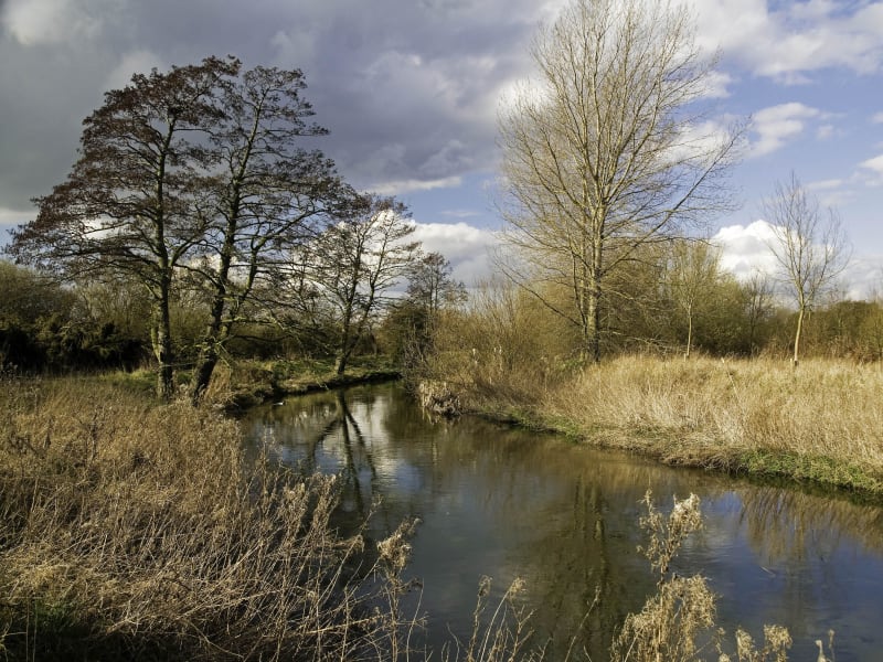
The Idle Valley Nature Reserve is found just north of Retford beginning at Bellmoor Lake and stretching for approximately three miles northward along the River Idle valley ending at Neatholme Pit.
Facilities and Access
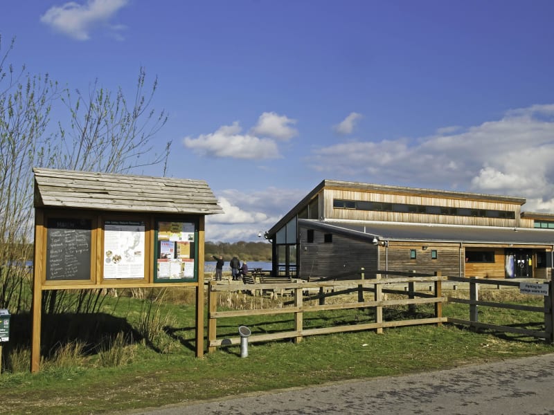
Idle Valley Rural Learning Centre
Directions
Following the A638 for ½ mile north of Retford turning right at the brown sign for the Idle Valley Nature Reserve which then leads you along a short tarmac road with the reserve entrance through a wooden gate on your right. Follow this road around a tight bend to an extensive car park (with a £3 voluntary parking charge) and the centre building is on your left overlooking Bellmoor Lake.
The Rural Learning Centre building is open from 10am - 3pm 7 days a week, including the Café. The Centre includes toilet facilities, a small reception desk for enquiries and display boards for information. Situated in the southern edge of our stunning nature reserve, the Idle Valley Cafe offers fantastic views within a beautiful setting. All purchases support Nottinghamshire Wildlife Trust and local wildlife. For children there is a bronze rubbing trail around the site, an outdoor play area and a picnic area beside the building. Visitors to Idle Valley are invited to enjoy the many footpaths and bridleways, together with seven viewing screens and a viewing platform. Our Bellmoor Lake walk is wheelchair accessible. There are four designated walks of varying lengths so whether you would like a quick stroll or a longer hike, there is something to suit everyone.
From here you can walk along various marked circular trails (see the reserve leaflet) to access Bellmoor Lake and the River Idle, the Bunker Wood/Bellmoor Pits and Tiln Wood/Tiln Pits areas.
Majority of Reserve
Directions
Northern parts of this huge reserve can also be accessed by car (parking sensibly) from Chainbridge Lane which runs east from Lound village crossroads, on foot from Neatholme Lane running northeast from Lound Village and by car from off the Hayton to Clayworth road crossing farmland heading west along Chainbridge Lane (track) to the River Idle Bridge. Suggested parking areas are along Chainbridge Lane by the horse paddocks close to Lound village Crossroads, at Chainbridge Scrape viewing screen, at Chainbridge Bridge on the eastern bank of the river.
For full writeups on the various parts of the reserve please visit the Site page
Key Bird Species
Over-wintering and breeding wildfowl, wetland birds, woodland birds, passage and breeding waders and passage migrants. The Turtle Dove is still present and breeds in good numbers despite declines throughout the rest of the UK. The site still holds nationally significant numbers of wintering Coots and Gadwall and was designated a SSSI for this and other reasons in April 2002.
History
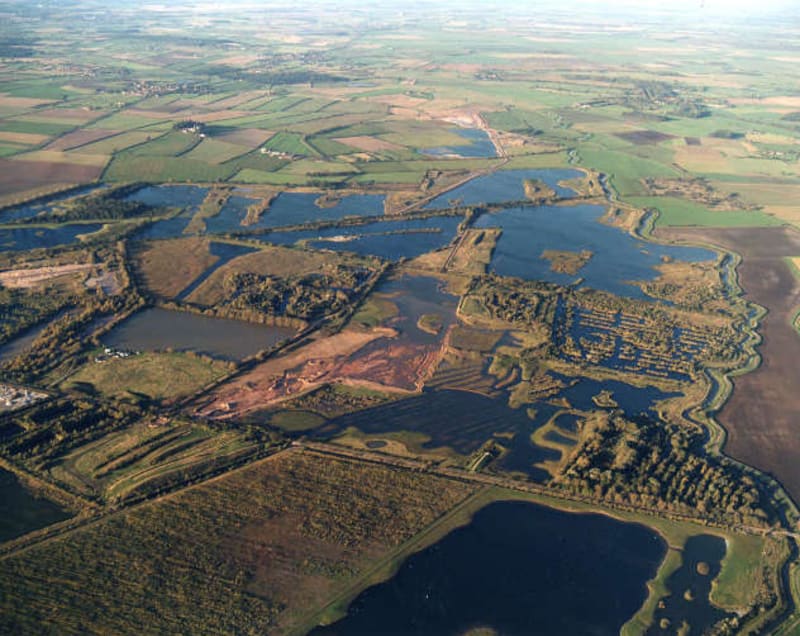
The Idle Valley Nature Reserve is part of the Idle Valley Project area, managed by Nottinghamshire Wildlife Trust. Originally the whole area was the site for sand and gravel extraction which commenced soon after the Second World War and the final extractions were completed by Tarmac Ltd in 2012. After over half a century of aggregate extraction the area is now being managed by NWT to improve the area for wildlife. In 1989 Tarmac sold a small piece of the former gravel quarry to NWT and from then on, a small committee of trust representatives, members of the former Chainbridge Nature Reserve Management Committee and Lound Bird Club began the slow process that finally led to the designation of 317 hectares of the quarry into a SSSI in April 2002. The Sutton & Lound Gravel Pits SSSI which is now known as the Idle Valley Nature Reserve was born but it took a further period to begin to introduce infrastructure which included several birdwatching screens, footpaths and finally a visitor centre which was built in conjunction with North Nottinghamshire College on land bought and owned by NWT in 2006. The Idle Valley Rural Learning Centre building was finally completed in 2008. In 2009 the land which was until now under the Tarmac ‘aftercare' agreement was handed over to the trust. Further acquisitions from Hanson and EDF took this spectacular wetland site to more than 450 hectares (the size of 600 football pitches) and is one of the largest sites for nature conservation in the East Midlands.
Habitat
The reserve consists mainly of former Tarmac/Hanson gravel quarry and abandoned EDF (formerly CEGB) settling lagoons which vary in size and age. Four distinctive quarry areas are still known within the reserve, and these include Hallcroft & Bellmoor Gravel Quarry, Sutton & Lound Gravel Quarry, Blaco Quarry and finally Tiln South & North Quarry. Small areas of the EDF site are now within the boundary of the reserve but the major parts of this former industrial PFA disposal site were put back to farmland after it was abandoned in the early mid 90's. In addition to the above, several more habitat types can be found within or adjoining the reserve including farmland, open water, woodland, reedbed, wetland, marsh, dry grassland, hedgerows, bare ground and scrubland. The diversity of habitat types along this huge linier reserve along the River Idle valley has been key to attracting the huge number of Fauna and Flora that have been recorded over the site. Nottinghamshire Wildlife Trust manage this site with the help of a small number of paid staff and the kindness and generosity of many local individuals who donate their time and effort towards the reserve. Volunteers are always welcomed so if you want to help local wildlife, please contact the wildlife trust staff at the Rural Learning Centre.